In the past, when we talked about space, we thought of moon landings, GPS, satellite communications, weather forecasting, and even the romance of human exploration.
But now, space is becoming a battlefield without smoke — one that can determine the outcome of war.
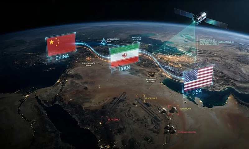
The Chinese Communist Party is connecting satellites, AI image analysis, cyber theft, and Arctic ground stations into a global intelligence network. Through this system, U.S. military bases, aircraft carriers, bombers, and even allied deployments could be exposed on an adversary’s screen.
According to the Financial Times, Iran secretly obtained a Chinese spy satellite and used it in recent conflicts to improve its ability to target U.S. military bases in the Middle East.
This means the threat facing American soldiers no longer comes only from Iranian missiles and drones. It now extends to the combination of Iranian weapons and China’s space-based intelligence system.
China does not need to pull the trigger itself. It can simply help America’s enemies see where to strike.

A major part of U.S. military superiority comes from information dominance: we know where the enemy is, while the enemy struggles to track our movements. We can detect first, assess first, and act first.
But when Chinese satellites and AI companies make U.S. bases, aircraft deployments, and battlefield operations more transparent, America’s security advantage is gradually weakened.
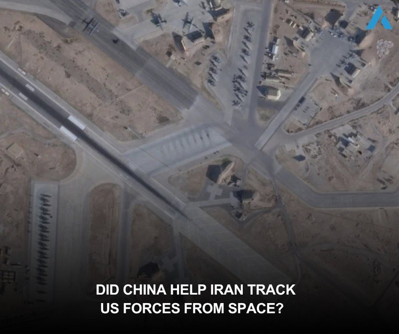
How Chinese Satellites Became a Tool for Iran to Target U.S. Forces
Public information indicates that the satellite is called TEE-01B. It was manufactured by the Chinese company Earth Eye Co. and launched from China. Iran’s Islamic Revolutionary Guard Corps Aerospace Force reportedly obtained the satellite in late 2024 to monitor U.S. military bases across the Middle East. What Iran acquired was no longer just a static map, but a battlefield view that could repeatedly observe, compare, and track changes in targets.
Once this capability falls into Iran’s hands, the danger increases significantly. U.S. bases in the Middle East are key nodes for regional military operations. They may host refueling aircraft, early warning aircraft, transport planes, ammunition depots, radar systems, air defense systems, and command centers. If an adversary can use satellites to monitor their locations and changes, it may later support missile calibration, drone attacks, or even post-strike battle damage assessment.
Satellite imagery becomes truly dangerous when it is combined with AI. AI-enhanced satellite images released by the Chinese geospatial AI company MizarVision are believed to have helped Iran identify U.S. military targets in the Middle East. Once these images are labeled and analyzed, users can quickly understand the locations of bases, runways, aircraft parking areas, and high-value targets.
At this point, commercial satellites are no longer just map services. In the past, advanced satellite reconnaissance capabilities were mainly held by a small number of states. Now, commercial satellites, AI image analysis, and data-service companies make similar capabilities easier to obtain. When these capabilities are controlled by Chinese companies and flow to anti-American regimes such as Iran, the concealment of U.S. forces on the battlefield is reduced, and the vulnerabilities of U.S. bases become more exposed.

U.S. House Select Committee on the Chinese Communist Party Chairman John Moolenaar sent a letter to U.S. Defense Secretary Pete Hegseth warning that satellite imagery from Airbus Space may have flowed to the Chinese entity Mi Entropy Technology Co., Ltd., also known as MizarVision. The letter stated that the imagery involved U.S. military assets in the Middle East and was acquired before Operation Epic Fury, creating serious military risks.
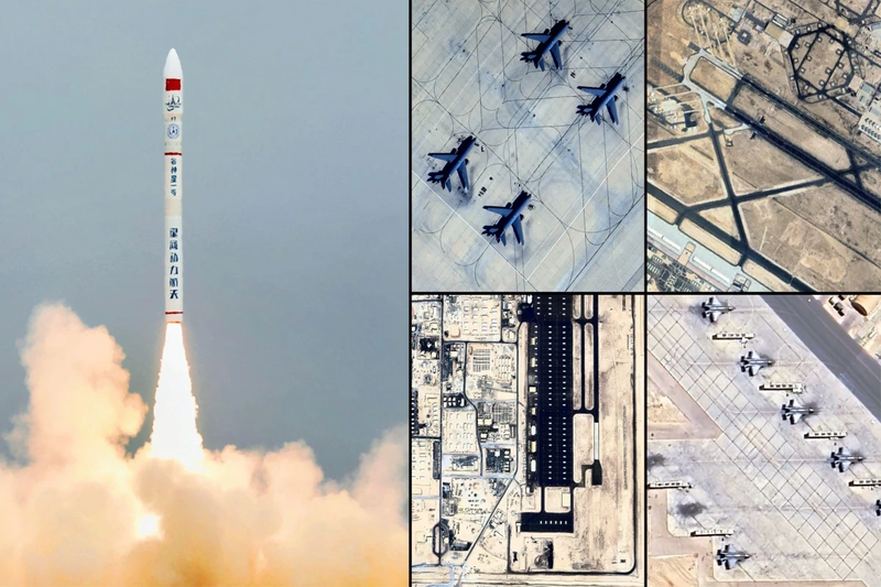
One of the most specific examples is that MizarVision reportedly published high-resolution satellite imagery of Prince Sultan Air Base in Saudi Arabia and labeled U.S. E-3G early warning aircraft and KC-135 refueling aircraft. Early warning aircraft are the brain of air operations, while refueling aircraft are the arteries of long-range missions. Once an adversary knows where these aircraft are located, the entire U.S. air operations chain faces greater risk.
This can be understood simply: if a hostile state only knows the general location of a base, it can only plan attacks roughly. But once it knows which aircraft is parked on which apron, which runway is active, and which hangar may contain important equipment, an attack can move from rough targeting to precision strikes. What Chinese satellites and AI analysis provide is exactly this capability: the ability to move from “seeing” to “targeting.”
The CCP Is Building a Space Intelligence Supply Chain — and Seeking to Steal U.S. Technology

Iran’s use of Chinese satellites to target U.S. military bases is only one visible part of a much larger intelligence network.
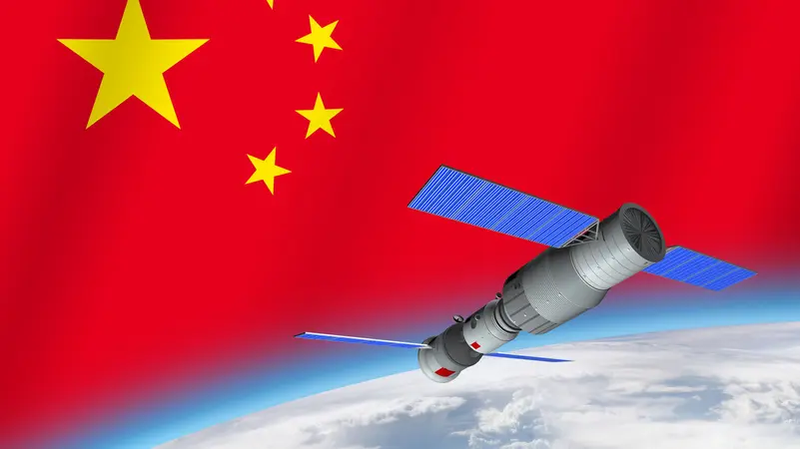
China is building a full space intelligence supply chain: ISR satellite constellations in orbit, satellite data companies on the ground, AI image analysis inside the system, hackers stealing technology online, and high-latitude nodes in the Arctic that can receive and transmit data. Together, these elements form an intelligence warfare network designed to support military operations.
The first layer of this supply chain is China’s growing ISR satellite constellation. ISR stands for intelligence, surveillance, and reconnaissance. For decades, the United States led in this field, allowing the U.S. military to understand the battlefield, track enemies, and protect its forces. But China is rapidly catching up, with the goal of making it harder for U.S. forces to remain hidden in the Pacific, the Middle East, the Arctic, and even across global deployments.

According to U.S. Space Force data, by November 2025 China had more than 1,301 satellites in orbit. Since the end of 2015, China’s on-orbit presence had increased by about 667 percent. This pace shows that China is using national strategy to drive space expansion, giving it the ability to observe Earth more frequently, return data faster, and better track U.S. aircraft carriers, Air Force deployments, and expeditionary forces.
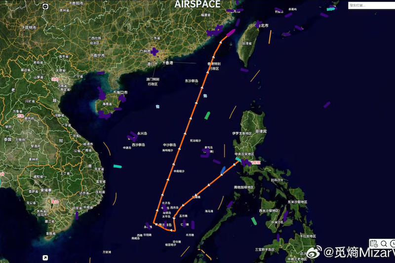
That means when a U.S. aircraft carrier leaves port, when bombers relocate, or when U.S. forces adjust deployments in Guam, Japan, the Philippines, Australia, or the Middle East, China may be able to continuously track them through satellites, ground stations, and AI analysis. This makes U.S. movements easier to anticipate and gives adversaries more time to prepare, evade, interfere, or even launch attacks.
But satellites alone are not enough. To turn satellites into a real military advantage, China also needs algorithms, engineering software, image-processing capabilities, and aerospace design know-how. In other words, while China expands its space assets, it is also targeting U.S. space technology on the ground.
NASA’s Office of Inspector General revealed that Chinese national Song Wu impersonated U.S. researchers and carried out a long-term spear-phishing campaign against NASA, the U.S. Air Force, Navy, Army, FAA, universities, and private companies. His goal was to obtain sensitive software that could be used for aerospace design and weapons development. This case directly targeted America’s aerospace and defense technology.
Even more importantly, Song Wu was an engineer at AVIC, China’s state-owned aviation and defense conglomerate. The technologies he targeted involved aerospace engineering, space design, fluid dynamics, simulation analysis, and military applications. This shows that China’s threat to U.S. space capabilities includes both competition in orbit and infiltration and theft on the ground.
Once these two lines are connected, the danger becomes clearer: in space, China uses satellites to watch U.S. forces; on the ground, China uses hackers to steal technology; and in between, AI and data companies turn imagery into usable intelligence.
This is the full picture of the CCP’s space intelligence warfare.
The U.S. intelligence community has also warned that China is the most active and persistent cyber threat to U.S. government, private-sector, and critical infrastructure networks. Space systems depend on ground control centers, communication links, software updates, data-processing centers, and supply chains. If any one of these links is infiltrated by Chinese hackers, the threat could expand from espionage to interference, sabotage, or even the disruption of critical capabilities during a crisis.
The Arctic, Civilian Technology, and Military-Civil Fusion: How the CCP Is Turning a Facade of Peace into Tools of War
Next, this intelligence network also extends into the Arctic.

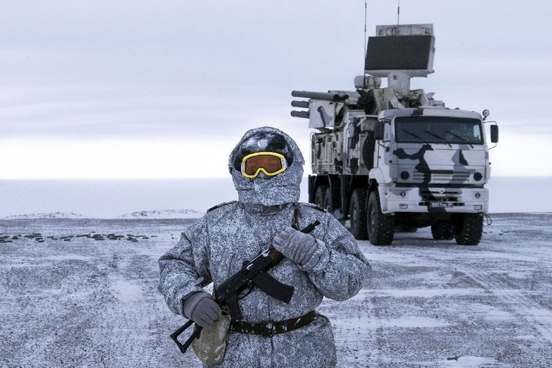
When many Americans hear “the Arctic,” they think of glaciers, polar bears, climate change, or scientific research. But militarily, the Arctic is America’s northern defense frontier. It is also a strategic space where missile routes, submarine activity, satellite communications, radar warning systems, and global shipping lanes intersect.
China is not geographically an Arctic state, yet it calls itself a “near-Arctic state” and has expanded its presence through scientific research, shipping, ground stations, and cooperation with Russia.
Earlier this year, Hybrid CoE released a study on China-Russia Arctic strategy and hybrid threat capabilities. The report noted that the capabilities, technologies, and infrastructure China and Russia are developing in the Arctic — especially civilian and multi-use capabilities — could support situational awareness, navigation, and operations in maritime and coastal environments. This means Arctic research and infrastructure carry potential intelligence and military risks.

China can claim that ground stations are used to study climate. It can say satellite data is for observing ice. It can present BeiDou navigation as a tool for shipping safety. But in modern warfare, navigation, communications, remote sensing, data reception, and situational awareness are all essential parts of military operations. That is exactly why dual-use capabilities are so difficult to defend against.
For the United States, the Arctic is not far away. It is tied to North American air defense, missile warning, undersea communications, satellite links, and the security of NATO’s northern flank. If China builds more data-reception, navigation-support, and satellite-link capabilities in the Arctic, what it can observe may include U.S. and allied military activity in high-latitude regions.
This is what makes the CCP especially dangerous: it can always package military capability as civilian technology. Satellites are “civilian.” AI is “commercial.” BeiDou is “navigation.” Arctic stations are “scientific research.” Data companies are “market-driven.” But under the CCP’s military-civil fusion system, once these capabilities are absorbed by national security needs, they can quickly be turned into tools serving military objectives.

Chinese satellites make it easier for Iran to target U.S. military bases, putting American soldiers at risk. Chinese hackers steal NASA and aerospace technologies, damaging America’s technological edge. China’s expanding ISR satellite constellation affects U.S. freedom of action. China’s Arctic ground stations carry dual-use risks that touch America’s northern homeland defense.
Taken together, these clues reveal the CCP’s space-based intelligence threat to the United States.
The threat China poses to America has already entered space, data, AI, and invisible intelligence chains. When U.S. bases are seen by Chinese satellites, when U.S. military aircraft are labeled by Chinese AI, and when U.S. space technology is targeted by Chinese hackers, this war has already begun in another form.
America must protect its space advantage, prevent commercial satellite data from flowing to hostile regimes, and stop China from disguising civilian technology as military intelligence tools. Otherwise, the next time a U.S. military base is targeted, what we may be seeing is the CCP opening its eyes in space on behalf of America’s enemies.